Services by Technology & Platform
Comprehensive remote sensing solutions across multiple platforms and technologies for diverse applications and requirements.

Satellite Remote Sensing
Comprehensive satellite imagery analysis using optical, radar, and thermal sensors. Access to global satellite constellations including Sentinel, Landsat, MODIS, and high-resolution commercial satellites for multi-temporal analysis and monitoring.
Core Service Types
End-to-end remote sensing services from data acquisition to advanced analytics and custom solutions.

Data Acquisition & Processing
Comprehensive data collection, preprocessing, calibration, and quality assurance for all remote sensing platforms.
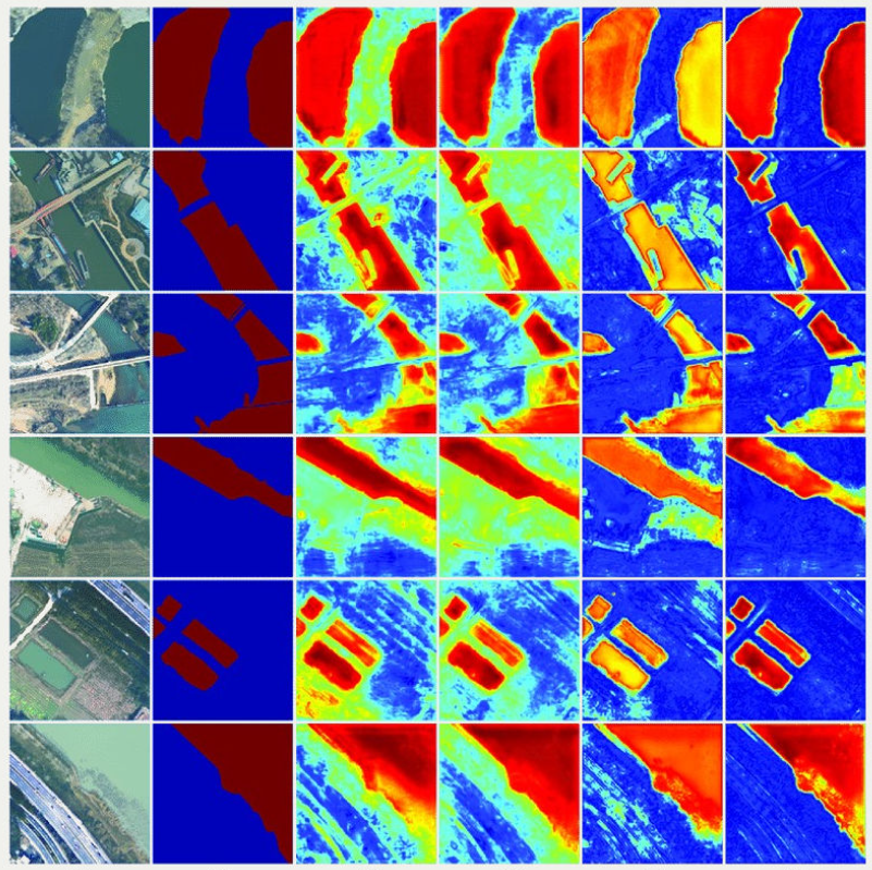
Image Analysis & Interpretation
Advanced image processing, classification, feature extraction, and visual interpretation by expert analysts.

GIS Integration & Mapping
Seamless integration with GIS platforms, thematic map creation, and spatial data management.

AI/ML-Powered Analytics
Machine learning and deep learning models for automated classification, pattern recognition, and predictive analytics.
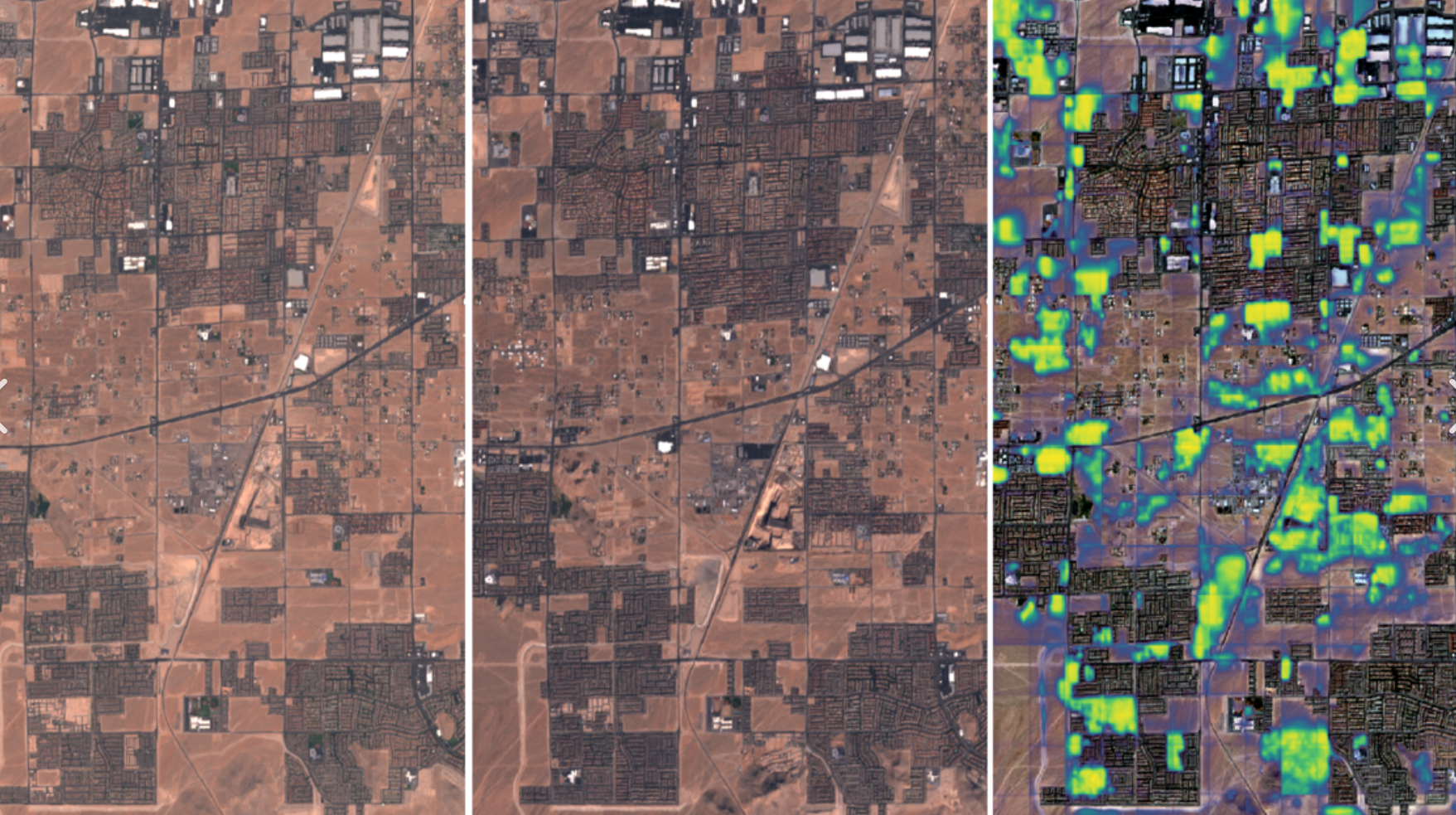
Change Detection Analysis
Multi-temporal analysis for monitoring changes over time, detecting trends, and identifying anomalies.

Consulting & Custom Solutions
Expert consulting services and tailored solutions designed for your specific requirements and objectives.
Remote sensing impact across sectors

Climate Change Impact Assessment
Comprehensive satellite-based analysis of climate change impacts on ecosystems, glaciers, and coastal regions using multi-temporal data.

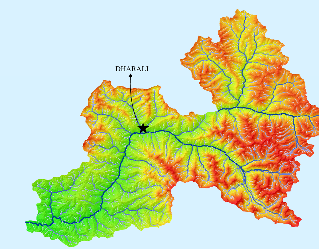
Flood Risk Mapping System
Real-time flood monitoring and risk assessment platform using SAR and optical imagery for emergency response planning.

Precision Agriculture Platform
Advanced crop monitoring and yield prediction system using multispectral and hyperspectral remote sensing data.
Our research drives real-world change
Ten specialized research domains covering the full spectrum of Earth observation analysis.
Land & Terrain Analysis
Our land and terrain analysis leverages high-resolution satellite imagery, LiDAR point clouds, and advanced machine learning algorithms to generate precise Digital Elevation Models (DEMs), Digital Terrain Models (DTMs), and comprehensive Land Use/Land Cover (LULC) classifications. We utilize multi-temporal Sentinel-2, Landsat-8/9, and commercial satellite data to detect urban expansion patterns, monitor land degradation, and assess soil erosion risks with sub-meter accuracy.
Environmental Monitoring & Analysis
We integrate Sentinel-5P TROPOMI data for atmospheric composition analysis, thermal infrared imagery for Land Surface Temperature (LST) monitoring, and hyperspectral sensors for water quality assessment. Our environmental monitoring solutions track NO₂, SO₂, CO, and aerosol concentrations, enabling governments and organizations to enforce emission regulations, identify pollution hotspots, and measure the effectiveness of environmental policies with spatial precision.
Ecological Monitoring & Analysis

Our ecological analysis employs vegetation indices (NDVI, EVI, SAVI, NDWI) derived from multispectral imagery to assess ecosystem health, map biodiversity hotspots, and track habitat fragmentation. We combine radar backscatter analysis with optical time-series data to estimate forest biomass, monitor wetland dynamics, and identify wildlife corridors—supporting conservation planning and REDD+ carbon stock verification with quantifiable accuracy.
Geological & Mineral Exploration

We apply ASTER, WorldView-3 SWIR, and hyperspectral imagery for lithological discrimination and hydrothermal alteration mapping. Our geological analysis integrates spectral unmixing algorithms to identify clay minerals, iron oxides, and carbonate signatures indicative of ore deposits. Combined with SAR interferometry for structural lineament detection and subsidence monitoring, we provide comprehensive exploration intelligence for mining and energy sectors.
Cryosphere & Glacier Monitoring
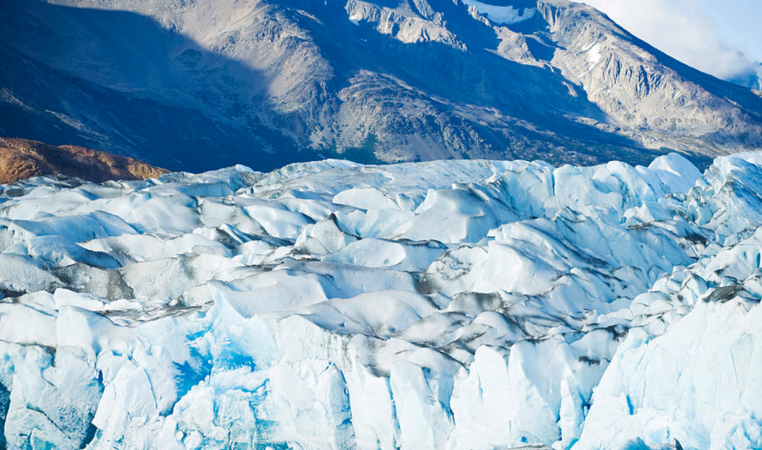
Our cryosphere research utilizes Sentinel-1 SAR coherence analysis, ICESat-2 altimetry, and Landsat thermal bands to quantify glacier mass balance, track ice sheet velocity, and map permafrost extent. We monitor Glacial Lake Outburst Flood (GLOF) risks by detecting supraglacial lake expansion and moraine stability, providing critical early warning data for high-mountain communities and downstream infrastructure planning in climate-vulnerable regions.
Water Resources & Hydrology

We leverage GRACE satellite gravimetry for groundwater storage anomaly detection, Sentinel-1 SAR for flood extent mapping, and optical imagery for reservoir surface area monitoring. Our hydrological models integrate terrain-derived drainage networks, soil moisture products from SMAP/SMOS, and precipitation data from GPM to support watershed management, irrigation planning, and transboundary water resource negotiations with data-driven precision.
Coastal & Marine Analysis

Our coastal research employs Satellite-Derived Bathymetry (SDB) algorithms on high-resolution multispectral imagery to map shallow water depths up to 25 meters. We analyze shoreline dynamics using time-series satellite data, monitor coral reef bleaching through thermal anomaly detection, and map mangrove ecosystems using SAR-optical fusion. Ocean color analysis reveals chlorophyll-a concentrations, harmful algal blooms, and sediment plume dispersion patterns.
Disaster Management & Risk Assessment
We provide rapid-response disaster mapping using SAR imagery that penetrates cloud cover for flood extent delineation, thermal sensors for active fire detection (VIIRS/MODIS hotspots), and change detection algorithms for post-earthquake damage assessment. Our multi-hazard risk models integrate topographic, geological, and climatological variables to generate landslide susceptibility maps, wildfire risk indices, and cyclone vulnerability assessments for emergency preparedness.
Forest & Vegetation Studies

Our forest monitoring combines Sentinel-1 radar backscatter with Sentinel-2 optical data for near-real-time deforestation alerts and forest degradation detection. We employ LiDAR-derived canopy height models and allometric equations to estimate above-ground biomass and carbon stocks for REDD+ MRV compliance. Machine learning classifiers distinguish tree species, detect forest stress from pest infestations, and map plantation boundaries with over 90% accuracy.
Agricultural Research
We deploy precision agriculture solutions using drone-based multispectral sensors and satellite imagery to generate prescription maps for variable-rate fertilizer application. Our crop monitoring systems track phenological stages, detect nutrient deficiencies through spectral signatures, and forecast yields using NDVI time-series and machine learning models. Soil moisture analysis from microwave sensors and evapotranspiration estimation optimize irrigation scheduling for water-efficient farming.
Deliverables & Outputs
Comprehensive deliverables tailored to your project requirements, from maps and models to reports and databases.